Point Clouds (IFMEPointCloud)
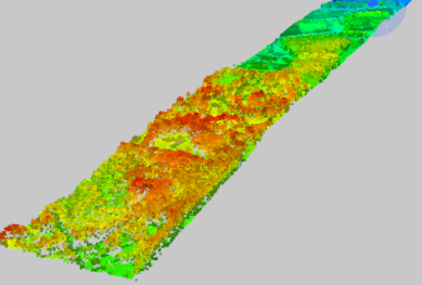
A point cloud geometry is a (potentially large) collection of points. Point clouds are useful for storing large amounts of data, often gathered from LIDAR applications.
Associated with each point are properties called components, which contain a value that describes the point. Components are similar to attributes, but at the point level instead of at the feature level. Note that all points in a point cloud have the same schema (that is, the same set of components), but each point may have a different value for each component.
All components have a name and type. Possible component types are Real64, Real32, UInt64, UInt32, UInt16, UInt8, Int64, Int32, Int16, Int8, and String. Numeric components additionally may have a scale and offset factor; in such cases, the applied value of the component is value x scale + offset. String components additionally may have an encoding.
While components may have any name, there are a few common components that exist in several formats. These components are described in the following table.
Note: This list is not exhaustive. A point cloud may have any number of components not listed here.
| Component Name | Description |
|---|---|
| x | The x component of the geometry. |
| y | The y component of the geometry. |
| z | The z component of the geometry. |
| intensity | The magnitude of the intensity of the pulse return. |
| color_red | The red image channel value at the point. |
| color_green | The green image channel value at the point. |
| color_blue | The blue image channel value at the point. |
| classification | The class of the point. Categorizes a point into fields, such as ground, building, water, and others. Values correspond to the ASPRS LAS specification. |
| return | The pulse return number for a given output pulse. |
| number_of_returns | The total number of detected returns from a single pulse. |
| gps_time | The number of seconds since the beginning of the week. |
| gps_week | The week number, counting from January 6th, 1980. |
| angle | The angle of the pulse that the point was scanned at. |
| flight_line | The flight line number the point was detected in. |
| flight_line_edge | Whether this point lies on the edge of the scan, along the flight line. |
| scan_direction | The direction in which a scanning mirror was directed when the point was detected. |
| point_source_id | A value that indicates the source of the file, such as a file number. |
| posix_time | Used to express the time, as the number of seconds elapsed since UTC January 1st, 1970. |
| user_data | Data to be used at the user’s discretion. |
| normal_x | The x component of the vertex normals. |
| normal_y | The y component of the vertex normals. |
| normal_z | The z component of the vertex normals. |
Note that there are no required components. For example, point clouds typically have all of the x/y/z components, but a point cloud may not have z (making it 2D), or may not have any of x/y/z (making it non-spatial).
Point clouds may also store a 4x4 transformation matrix, which is applied to the x/y/z components.
Point Cloud Attributes
- fme_geometry = fme_polygon
- fme_type = fme_point_cloud