You are here: Popular Formats > Esri Geodatabase Reader/Writer > Overview > Conceptual Diagram of Geodatabase
Below is a simplified diagram of some of the objects within Geodatabase. Labels describe the relationship between objects.
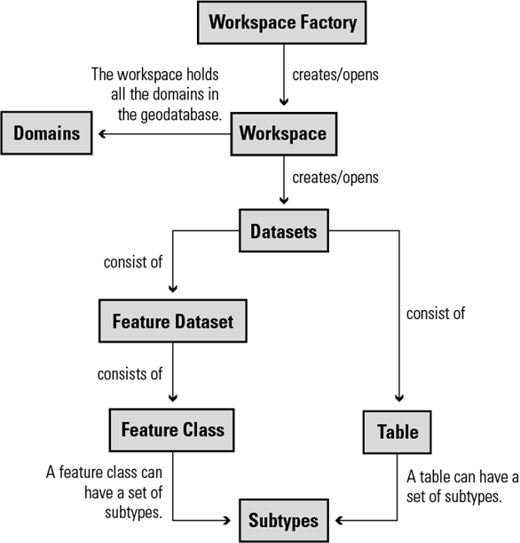
|
Label |
Relationship between objects |
|---|---|
| Workspace Factory | An object that allows you to connect to a workspace. The workspace factory is format-dependent. This means that a different workspace factory is used to open an ArcSDE Workspace than to open a Microsoft Access workspace. |
| Workspace | A data source that contains datasets. The workspace represents the actual Geodatabase being created or opened. |
| Dataset | A collection of data that is grouped together. Examples include feature classes, tables, and feature datasets. |
| Table | A container of non-spatial data. It is never part of a feature dataset. |
| Feature Class | A container of spatial data. It may be part of a feature dataset, or standalone. |
| Feature Dataset | A container of feature classes. All the feature classes within the feature dataset share the spatial reference of the feature dataset. |
| Domain | An object that is used to constrain a field in a feature class or table to an allowable value for that field. |
| Subtype | An object that is used to separate rows (features) in a table (feature class) into different groups so that different default values or validation rules can be used for each group. |