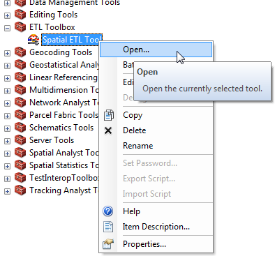
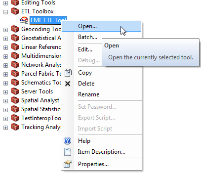
Opening an Existing FMESpatial ETL Tool
You can use an existing FMESpatial ETL Tool to write the feature classes to an output staging geodatabase for
further translation into geodatabase feature classes and tables.
- Follow the instructions
for creating a new FMEspatial ETL tool.
- From ArcToolbox, double
click the FMESpatial ETL Tool that you want to
use, or right-click and choose Open.
The FMESpatial ETL tool dialog appears.
The source and destination dataset
fields contain the information that was specified when the transformation
tool was created.
- Browse to the dataset.
- Select the dataset (or layer, as shown below).
- The path will appear in the list.
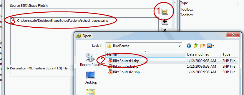
- Repeat for each input
layer.
- Click OK.
A
status window displays information and transformation statistics while
the layers are being written to the destination dataset.