General
This parameter allows you to choose different naming schemes for a feature type, and the number of feature types generated for the reader.
The Feature Type Name changes, depending on the selection.
| Value | Feature Type Name | Example |
|---|---|---|
|
From Format Name |
<reader_type_name> |
FORMAT_NAME |
|
From Subdataset Name |
<subdataset_name> |
subdataset |
Each Sentinel-2 product contains four datasets:
- 10 meter
- 20 meter
- 60 meter
- RGB preview
The resolution-specific datasets consist of the following bands from the original Sentinel-2 data:
- 10 meter: B2 (490 nm), B3 (560 nm), B4 (665 nm) and B8 (842 nm)
- 20 meter: B5 (705 nm), B6 (740 nm), B7 (783 nm), B8a (865 nm), B11 (1610 nm) and B12 (2190 nm)
- 60 meter: B1 (443 nm), B9 (940 nm) and B10 (1375 nm)
(From https://earth.esa.int/web/sentinel/user-guides/sentinel-2-msi/resolutions/spatial.)
Spatial Filter
Specify a UTM Zone between 1 and 60
Specify a UTM Latitude Band between C and X, excluding I and O
Specify an MGRS Square valid for the selected zone and band. The ID is a two-letter identifier. First letter: A-Z, excluding I and O. Second letter: A-V, excluding I and O. A particular grid zone will not have all possible MGRS square IDs.
Specify minimum and maximum latitude and longitude values in LL84 coordinates.
Date Filter
Latest: Get the latest imagery only for the selected grid squares. This may produce more than one feature if there is more than one sequence available for a particular grid square on any of the specified dates.
All: Get all available imagery for the selected grid squares.
Date Range: Type the start and end dates, or select them from the displayed calendars.
Selected Dates: A date is displayed if one or more of the selected grid squares are available on that date. Selecting a date will download all grid squares inside the selection which are available on the selected date.
Using the minimum and maximum latitude and longitude parameters, define a bounding box that will be used to filter the input features. Only features that intersect with the bounding box are returned.
If all four coordinates of the search envelope are specified as 0, the search envelope will be disabled.
Coordinates must be in LL84. These parameters correspond to a GeometryFilter in the Planet Data API.
Schema Attributes
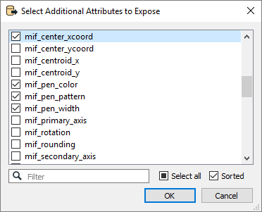
Use this parameter to expose Format Attributes in Workbench when you create a workspace:
- In a dynamic scenario, it means these attributes can be passed to the output dataset at runtime.
- In a non-dynamic scenario where you have multiple feature types, it is convenient to expose additional attributes using this one parameter. For example, if you have ten feature types and want to expose the same attribute in each one, it is easier to define it once than it is to set each feature type individually in the workspace.
