| Database Connections |
|---|
|
Connections store authentication information. For general information about sharing database connections, please see Using Database Connections. Note that different subsets of Database Connection parameters are made available in different contexts. Select an existing connection, or Add Database Connection to define a new connection. The new connection can be made visible only to the current user, or can be shared among multiple users. |
| Adding a Database Connection for Intergraph GeoMedia Access Warehouse and GeoMedia SQL Server Warehouse |
|---|
|
Note that parameter selection may vary, depending on the format and Authentication method. Entering a descriptive name allows you to easily find the connection in future workspaces. The following characters are not allowed in connection names: ^ \ / : * ? " < > | & = ' + % # Specifies the name of the server hosting the Microsoft SQL Server that stores the GeoMedia warehouse. The name of the database to connect to. When connecting through a Windows user account, select Windows Authentication. The database can validate the account name and password using the Windows principal token in the operating system. The user account is retrieved by Windows, so if you choose Windows Authentication, the Username and Password parameters are ignored. Select SQL Server Authentication to proceed with specifying login credentials through the Username and Password parameters. When Authentication is set to SQL Server Authentication, enter the username and password to access the database. |
Constraints
After you have specified the database connection, click the Browse button to select tables for import. A connection window appears while the system compiles a table from the database.
Once the table list appears, you can select one or more tables, and then click OK to dismiss the window. The table name(s) will appear in the Table List field in the parameter box.
Any SQL where clause can be applied to the columns of a table to limit the resulting features.
Text Options
GeoMedia can store text in two variations: plain text and rich text. Since FME supports plain text only, the GeoMedia reader will convert all rich text to plain text and set the text size to the default (1 ground unit).
Schema Attributes
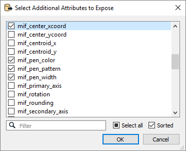
Use this parameter to expose Format Attributes in Workbench when you create a workspace:
- In a dynamic scenario, it means these attributes can be passed to the output dataset at runtime.
- In a non-dynamic scenario where you have multiple feature types, it is convenient to expose additional attributes using this one parameter. For example, if you have ten feature types and want to expose the same attribute in each one, it is easier to define it once than it is to set each feature type individually in the workspace.

Using the minimum and maximum x and y parameters, define a bounding box that will be used to filter the input features. Only features that intersect with the bounding box are returned.
If all four coordinates of the search envelope are specified as 0, the search envelope will be disabled.
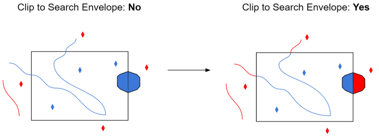
When selected, this parameter removes any portions of imported features being read that are outside the Search Envelope.
The example below illustrates the results of the Search Envelope when Clip to Search Envelope is not selected (set to No) and when it is selected (set to Yes).
- No: Any features that cross the search envelope boundary will be read, including the portion that lies outside of the boundary.
- Yes: Any features that cross the search envelope boundary will be clipped at the boundary, and only the portion that lies inside the boundary will be read. The underlying function for the Clip to Search Envelope function is an intersection; however, when Clip to Search Envelope is selected, a clipping operation is also performed in addition to the intersection.

Advanced
How the GeoMedia oriented points will be read. If Yes, all GeoMedia oriented points are returned with orientation information. If No, all GeoMedia-oriented points are returned as normal points without orientation information.
If this parameter is set to Yes, feature geometry will be read into an aggregate. A directive is set on the aggregate to indicate that each part of the aggregate is independent from the others, and its own geometry.
Geometry parts of the aggregate are named and contain geometry according to their respective column in the table.
Note: When using this feature, the feature type SELECT statement may not be specified.