General
Select the product type to read:
- Terrarium (PNG): A 24-bit fixed point representation of elevation in meters, split over the red, green, and blue bands. To decode:
(red * 256 + green + blue / 256) - 32768
- Normal (PNG): A 3-D vector representing the surface direction, and an 8-bit elevation value. The red, green and blue bands hold the x, y and z magnitudes, respectively. The alpha band contains quantized elevation data, with more opaque cells representing lower elevation. For more information on parsing this data, please see the Mapzen Terrain Tiles service documentation.
- GeoTIFF (GeoTIFF): Raw 16-bit integer elevation data in meters, suitable for analysis.
- Skadi (SRTM HGT): 16-bit elevation data in meters, in unprojected WGS84 coordinates.
A Mapzen API key is required to use the Mapzen Terrain Tile service through Mapzen’s CDN. The service is free to use, but requires registration with Mapzen to obtain an API key.
By default, a Mapzen web connection should be supplied, but this option allows you to embed an API key.
Tile Resolution
Tile Resolution settings apply to Terrarium, Normal, and GeoTIFF. Skadi tiles are only available at one resolution, and are not in a projected coordinate system.
Due to the nature of the web map tiling scheme, terrain data is available at 16 different resolution levels. The zoom level can be chosen directly as an integer, or a minimum target resolution can be specified.
- Zoom Level: This parameter is available when Resolution is set to Use Zoom Level. Select a zoom level from 0 (default) to 15 (where 0 is the lowest resolution, and 15 is the highest resolution). Tiles will be downloaded at the selected zoom level. Please note that tiles at higher zoom levels are oversampled from coarse source data.
- Target (m/cell:) This parameter is required when Resolution is set to Use Target Resolution. Provided the requested resolution level is available through the service, data will have a resolution no more than the specified number of meters per cell (pixel). The Web Mercator system used for the Terrarium, Normal, and GeoTIFF formats is not equidistant, and has severe distortion at high latitudes. The target resolution specified here refers to the resolution in the coordinate system, rather than ground resolution.
Spatial Filter
Tiles can be selected individually or by search envelope. If both options are selected, the single tile will only be read if it is also within the search envelope.
Tile X/Y Index: The index of the tile to select.
For Terrarium, Normal, and GeoTIFF tiles, valid ranges will vary depending on the zoom level: at zoom level 0, the only tile is at x=0, y=0; at zoom level 15, valid indexes range from 0 to 32767.
For Skadi tiles, valid indexes range from -180 to 179 for X (longitude) and -90 to 89 for Y (latitude).
Envelope
Using the minimum and maximum latitude and longitude parameters, define a bounding box that will be used to filter the input features. Only features that intersect with the bounding box are returned.
If all four coordinates of the search envelope are specified as 0, the search envelope will be disabled.
Coordinates must be in LL84.
Schema Attributes
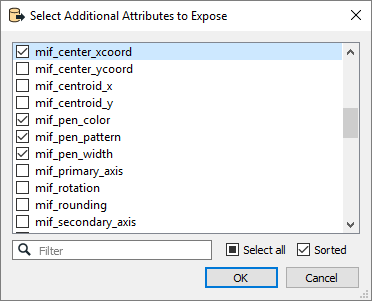
Use this parameter to expose Format Attributes in Workbench when you create a workspace:
- In a dynamic scenario, it means these attributes can be passed to the output dataset at runtime.
- In a non-dynamic scenario, you can use this parameter to expose additional attributes on multiple feature types.
