General
Allows you to choose different naming schemes, and the number of feature types generated for the reader.
|
Value |
Description |
Feature Type Name |
Example |
|---|---|---|---|
|
Bands |
Produces a feature type for each selected band. |
<band_name> |
B1 |
|
Format Name |
Produces only a single feature type containing the format name. |
<reader_type_name> |
LANDSAT8AWS |
Click the browse button to select feature types from the list. If no feature types are specified, then all available feature types will be read.
- Full Resolution: Download full-size GeoTIFFs.
- Overview: Download GeoTIFF overviews, which are smaller in file size.
Spatial Filter
Landsat data is identified by path and row numbers of the Worldwide Reference System (WRS). The combination of a path and row number uniquely identifies a nominal scene center.
For more information on how path and row numbers are assigned, please visit Landsat Science.
Using the minimum and maximum latitude and longitude parameters, define a bounding box that will be used to filter the input features. Only features that intersect with the bounding box are returned.
If all four coordinates of the search envelope are specified as 0, the search envelope will be disabled.
Coordinates must be in LL84.
Date Filter
- Latest: Get the latest imagery only for the selected grid squares. This may produce more than one feature if there is more than one sequence available for a particular grid square on any of the specified dates.
- All: Get all available imagery for the selected grid squares.
- Date Range: Type the start and end dates, or select them from the displayed calendars.
- Selected Dates: A date is displayed if one or more of the selected grid squares are available on that date. Selecting a date will download all grid squares inside the selection which are available on the selected date.
- Maximum Percentage Cloud Cover: The maximum percentage of the image that may contain cloud cover. Images with more cloud cover than this threshold are skipped.
- Minimum Data Quality Assessment: The minimum percentage of the image that contains usable data. Images with less usable data than this threshold are skipped.
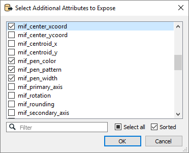
Schema Attributes
Use this parameter to expose Format Attributes in Workbench when you create a workspace:
- In a dynamic scenario, it means these attributes can be passed to the output dataset at runtime.
- In a non-dynamic scenario, you can use this parameter to expose additional attributes on multiple feature types.
