| Database Connections |
|---|
|
Connections store authentication information. For general information about sharing database connections, please see Using Database Connections. Note that different subsets of Database Connection parameters are made available in different contexts. Select an existing connection, or Add Database Connection to define a new connection. The new connection can be made visible only to the current user, or can be shared among multiple users. |
Database Connection
If you have already selected the file-based database connection from the Add Reader or Add Writer dialog, you will be prompted for the file or folder from the Add Database Connection dialog, and this parameter group will not be visible.
Parameters
Specifies the zoom level that will be used when reading the GeoPackage Tiles tile data.
The default is the maximum possible resolution zoom level.
This parameter allows you to choose different naming schemes for a feature type, and the number of feature types generated for the reader. The Feature Type Name changes, depending on the selection.
|
Value |
Feature Type Name |
Example |
|---|---|---|
| From Format Name | <reader_type_name> | GEOPACKAGE_RASTER |
| From File Name | <filename> | file |
| From Subdataset Name | <tiles_table_name> | tiles |
Advanced
The GeoPackage standard requires that all foreign key values in a GeoPackage database are valid (see Requirement 7 of the specification).
- Yes (default): The reader will ensure that all foreign key values in the database are valid before reading any data. If any foreign keys are invalid then the translation will fail.
- No: The reader will attempt to read the data without performing any foreign key checks.
Using the minimum and maximum x and y parameters, define a bounding box that will be used to filter the input features. Only features that intersect with the bounding box are returned.
If all four coordinates of the search envelope are specified as 0, the search envelope will be disabled.
Specifies the coordinate system of the search envelope if it is different than the coordinate system of the data. The coordinate system associated with the data to be read must always be set if this parameter is set.
If this parameter is set, the minimum and maximum points of the search envelope are reprojected from the Search Envelope Coordinate System to the reader’s coordinate system prior to applying the envelope.
Schema Attributes
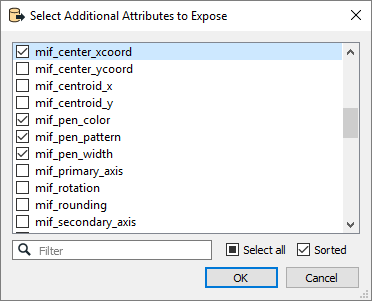
Use this parameter to expose Format Attributes in Workbench when you create a workspace:
- In a dynamic scenario, it means these attributes can be passed to the output dataset at runtime.
- In a non-dynamic scenario, you can use this parameter to expose additional attributes on multiple feature types.
