File Parameters
This password is used to decrypt the source dataset.
If applicable, it must exactly match the passphrase that was used to encrypt the dataset when it was created.
Constraints – Spatial Index (.fsi) Required
All feature type and spatial constraints below require the presence of a spatial index (.fsi file) alongside the dataset.
Tip: A spatial index can be created when writing the FFS dataset using the FFS writer or Recorder transformer by setting the Create Spatial Index parameter to Yes. The Inspector transformer, Data Inspector, and Run Workspace with Full Inspection mode also create spatial indexes for any temporary FFS files.
Use this parameter to specify specific feature type(s) in the source dataset using a space-delimited list of quoted feature type names.
Alternatively, click the browse button to generate a list of the existing feature types in the source dataset that are available for selection.
Using the Search Closest Point X, Search Closest Point Y, and Search Closest Max Distance parameters, define a 2D point and a radius in the units of the dataset that will be used to retrieve only the closest input feature.
If no features are within the max distance, then no features will be returned. If more than multiple features are the exact same distance from the Search Closest point, only the first feature will be returned. Z values are ignored in the closest search operation.
Note: The Search Closest Point and Use Search Envelope options are mutually exclusive. Thus, this Search Closest Point will not be employed if the Search Envelope constraint is also used.
Using the minimum and maximum x and y parameters, define a bounding box that will be used to filter the input features. Only features that intersect with the bounding box are returned.
If all four coordinates of the search envelope are specified as 0, the search envelope will be disabled.
Specifies the coordinate system of the search envelope if it is different than the coordinate system of the data. The coordinate system associated with the data to be read must always be set if this parameter is set.
If this parameter is set, the minimum and maximum points of the search envelope are reprojected from the Search Envelope Coordinate System to the reader’s coordinate system prior to applying the envelope.
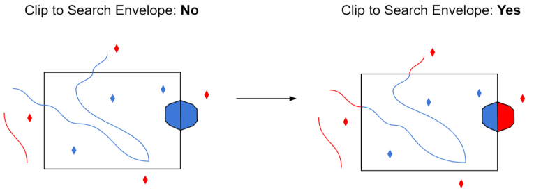
When selected, this parameter removes any portions of imported features being read that are outside the Search Envelope.
The example below illustrates the results of the Search Envelope when Clip to Search Envelope is not selected (set to No) and when it is selected (set to Yes).
- No: Any features that cross the search envelope boundary will be read, including the portion that lies outside of the boundary.
- Yes: Any features that cross the search envelope boundary will be clipped at the boundary, and only the portion that lies inside the boundary will be read. The underlying function for the Clip to Search Envelope function is an intersection; however, when Clip to Search Envelope is selected, a clipping operation is also performed in addition to the intersection.

Schema Attributes
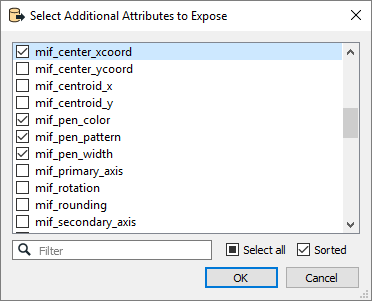
Use this parameter to expose Format Attributes in Workbench when you create a workspace:
- In a dynamic scenario, it means these attributes can be passed to the output dataset at runtime.
- In a non-dynamic scenario, you can use this parameter to expose additional attributes on multiple feature types.
